Aircraft
Gallery captions written by John Ward (President & Historian......49Squadron Association)

When 49 moved to Fiskerton and re-equipped with Mk IIIs R5751 stayed at Scampton and joined 57 Sqn. She survived the war!
(RAF Scampton)

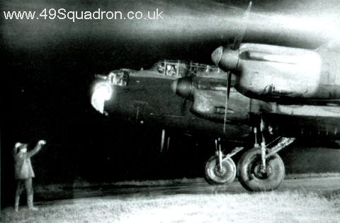
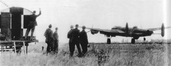
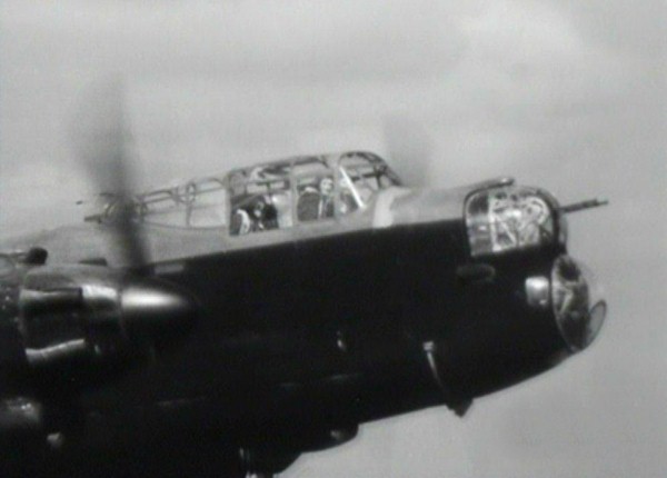
Fiskerton: Back from Berlin 22/23-11-43; (JB362) Bandlaw D-Donald trundles back into dispersal after bombing Berlin from 20,000ft with a frosted-over windscreen!
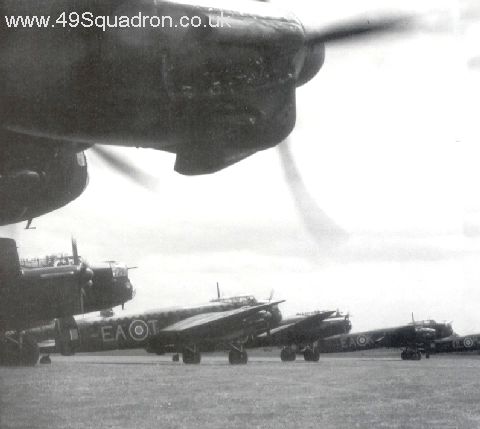
Follow the Leader - A gaggle of 49 Sqn Lancasters taxying down one of Fiskerton's short runways in a south-westerly direction during 1944. They are just about to cross the FIDO lined main runway. Note how the heat has distorted the FIDO pipes.
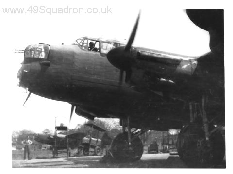
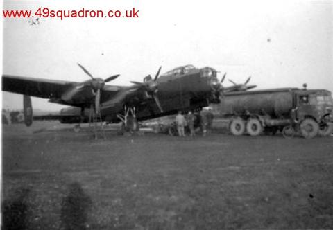
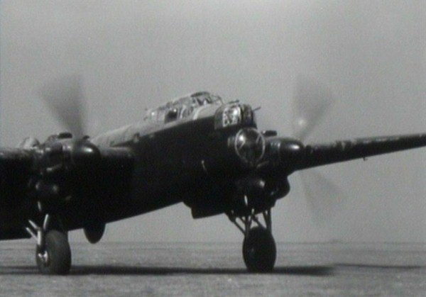
'A' Flt dispersal at Fiskerton circa June 1943: Lancaster ED416 J-Johnny about to be refuelled from the bowser. Just discernible are the legs of an instrument 'basher' who is standing on the legs of the undercarriage putting fresh silica gel (drying agent) in the instrument circuit - there is a tin of gel standing on the wheel. (T.N. Simpson)
Details to be published shortly
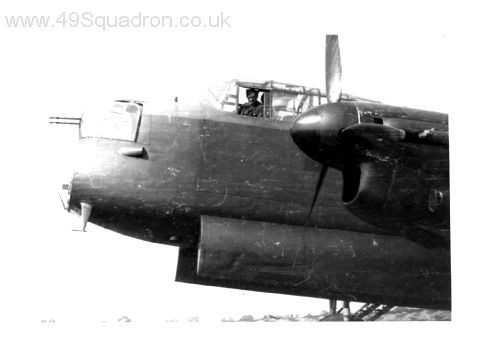
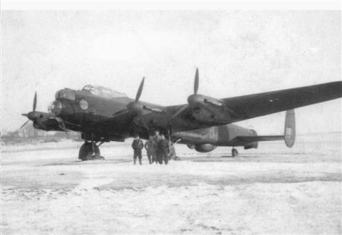
This magnificent picture is of W/C Slee's second Lancaster (D-Donald) ED702
and taken in April 1943 at Fiskerton. She is brand new and so is Fiskerton
- they haven't been allocated dispersals yet (in alphabetical order)
so this shot is taken east of the hanger on the main site,
looking north towards the start of the main runway.
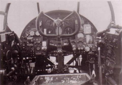
A pilot's eye view from a Hampden bomber. No 'fly by wire' technology here.
The above picture was taken by Joe Unsworth. John "Super Sleuth" Ward (49Sqn Association President) has identified the location as follows:
Look to the middle left distance and you will discern, through the murk, airfield runways. Now to my knowledge no airfields in 1940 Lincolnshire were blessed with concrete landing strips.
So my next line of thought.....where would 49Sqn be in 1940, where they could possibly be near such an air field and also to coincide with Sgt Unsworth being on the squadron (with his camera).
The first record of Joseph Unsworth in the air (on patrol) was as Robinson's navigator on 2nd March 1940.
Where were they operating from.....RAF Kinloss.....did Kinloss have concrete runways in 1940, apparently so.
On to Google Earth....does the runway configeration match the photo?
Yes when viewed looking from the south.
So what about the road layouts to the bottom bottom left of shot?
After careful study they would fit in with this being the small town of Springfield.....the unusual markings to the bottom right are still a mystery.
Sgt Unsworth was also airborne on the 4th March 1940 from Kinloss..... so I believe this was taken on either of these two dates.
49Sqn Hampdens at RAF Kinloss in 1940 (probably giving air experience flights)
49Sqn Hampdens at RAF Kinloss in 1940 (probably giving air experience flights)
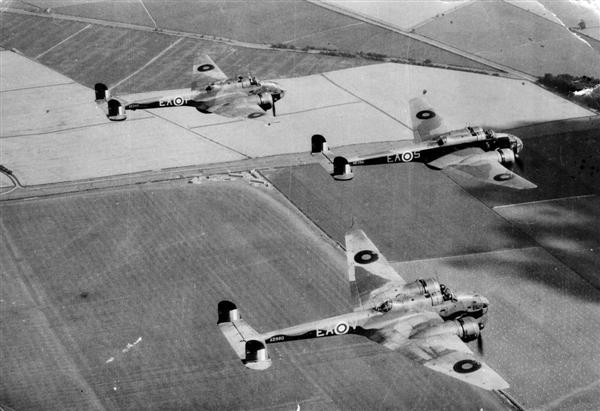
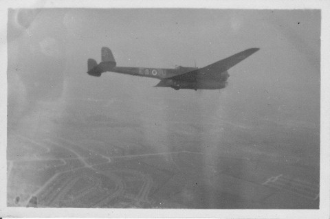
A fine photograph of three 49Sqn Hampdens (AE240, AE354 and AD980)

A fine air to air shot of AD980 V for Victor flying over Wellingore airfield just south of Lincoln.....this is the airfield from which Guy Gibson flew his night fighter tour on Beaufighters. AD980 was 57 op veteran when passed over to 408 Sqn RCAF at Balderton near Newark. In her new guise of EQ - Y she ended her days at 12.30hrs on Saturday 6th June 1942 crash landing in a field north of the airfield. The crew had been on a Night Flying Test in preperation for the nights op to Emden. The aircraft suffered 'stabiliser yaw', a common occurance on Hampdens due to the small tail fins.
P/O Wishart RAAF and Sgt Elliott (who had just completed his tour and was awaiting posting) were injured and taken to Newark hospital. The pilot, who was also injured had the distinction of writing-off two Hamdens in three days. The previous Thursday 4th June 1942 at 17.20hrs, again on an Air Test, he wrote-off AT180 another former 49 Sqn kite EA-G. On this occasion, in a flat spin the bomb doors were torn off but P/O Harry John Randall managed to recover and crash landed in fields near Claypole.
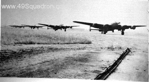
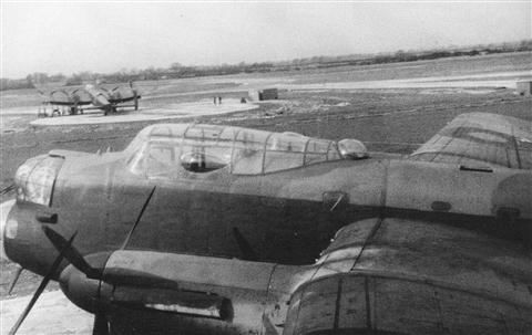
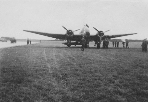
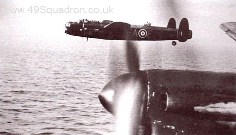
A 49 Sqn Lancaster seen landing/taking off on Fiskerton's main runway travelling east to west. The poplar trees in the far distance are towards Reepham and not too far from the Stuffins' family farm.

An excellent air to air shot showing EA-P (PB522/G). She flew at least 40 ops with 460 RAAF Sqn from Binbrook between 31/10/44 and 10/4/45.
Therefore she must have arrived at either Fulbeck or Syerston after that date.
"/G" means guard on the ground if landed away
- this is due to carrying the then secret AGLT.
She is definitely over Lincolnshire - our Historian has studied the
shot closely and discovered P-Peter is flying in a westerly direction
between the villages of Coleby (bottom left) and Harmston
(centre with the hospital complex visible).
The road in the lower foreground is the B607 Grantham to Lincoln road
passing through Waddington which is just off to the top right.

This is a super shot of Hamdens of 144 Sqn above RAF Hemswell,
possibly just pre-war. The main subject is L4125 - she operated with 49 Sqn
from 05 Nov 41 until 07 Feb 42. Her career was terminated when F/S Reid RNZAF
and crew crashed into a large snow bank during take - off from Scampton.
Fortunately the only casualty was the aircraft.
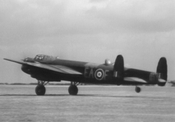
The subject aircraft is L7493 EA - F for Freddie.
She is a Mk 1a..... that is, unlike the Mk1's the dorsal fin has been removed
and larger tailplane fins (as the forthcoming Lancaster) have been added.
The turbulence caused by the mid-upper turret on the Mk 1s
caused the fabric to strip on the dorsal fin.
L7493 flew two ops 49 Sqn......S/Ldr Peter Ward-Hunt and crew took
Freddie to Cologne 30/31st May 1942, the first 1000 bomber raid!
Sgt Burton and crew then took her to Essen 1/2 June 1942 the 'Thousand Raid'.
She eventually ended up at 1660 Heavy Conversion Unit at
RAF Swinderby and was "Struck off Charge" in late 1943.
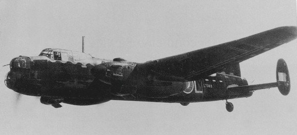
Avro Manchester Mk I L7389 EA-L. She flew two operations with the squadron; Sgt Burton and crew took her to Cologne (1,000) 30th May 1942. S/L De Mestre and crew went to Essen (1,000) 1st June 1942 She ended up at 1660 HCU Swinderby
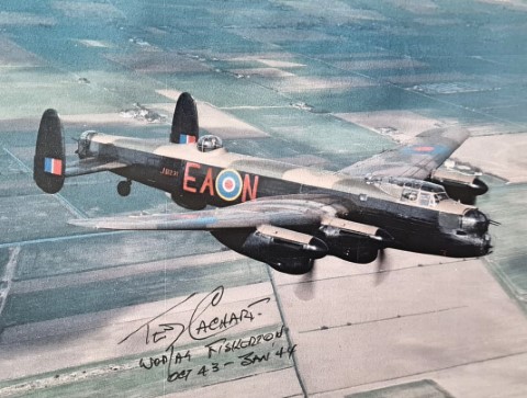
Signed photograph of a painting by John Ward
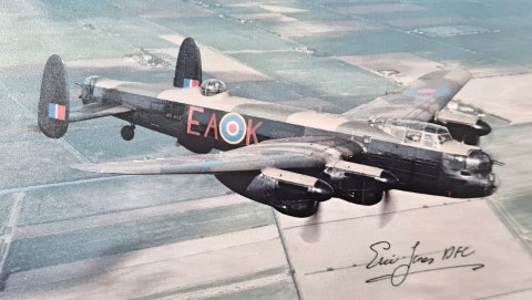
Signed photograph of a painting by John Ward
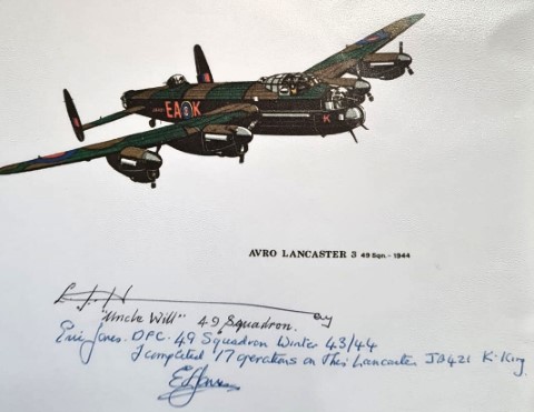
Signed photograph of a painting by John Ward